C-Map Reveal Electronic Map Charts
C-Map Reveal Electronic Map Charts
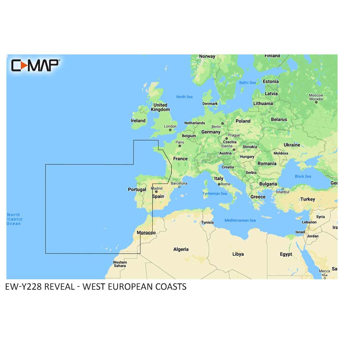
SKU: AF-M-EW-Y228-MS
Delivery available | lead times vary
Collection available | usually ready in 2-4 days
Description
Description
C-Map Reveal Electronic Chart Maps are compatible with Lowrance, Simrad and B&G Chartplotters.
C-Map is the premium mapping solution for cruisers, anglers and sailors looking for accurate, quality data with game-changing shaded relief from the market-leader.
C-Map Reveal charts offer the very best of C-Map; whether cruising, fishing or sailing. With "Shaded Relief", and the game-changing Reveal Seafloor Imagery, Aerial Photography, Satellite Overlay and Dynamic Raster Chart presentation added to the core C-MAP features found in Discover – full-featured Vector Charts, with Custom Depth Shading, Tides & Currents and subscription-free Easy Routing. It also includes the very best of C-Map High-Res Bathymetry, including integrated Genesis data. Purchase includes 12 months of free online updates.
Shaded Relief brings the world around you to life, with 3D rendered land and underwater elevation, including areas of Ultra-High-Res Bathymetric seafloor imagery, that were previously only available in Max-N+ Reveal - a game-changer for anglers and divers.
Full-Featured Vector Charts make navigation easy by giving you accurate, up-to-date vector chart detail derived from official Hydrographic Office information.
High-Res Bathymetry helps you identify shallow areas, drop-offs, ledges, holes or humps. This now includes compiled and quality-controlled Genesis detail as part of singular HRB layer.
Custom Depth Shading sets a clear safety depth, maintain a paper-like view or create your own custom shading.
Dynamic Raster Charts provide the traditional chart look and feel, coupled with easy access to all objects on the chart.
Easy Routing helps you automatically plot the shortest, safest route based on detailed chart data and your personalised vessel information, with no subscription required!
A collection of thousands of aerial photos of marinas, harbours, inlets and other notable navigational features are included to offer an additional level of detail.
Satellite Overlay imagery gives information about the surroundings when you find yourself in an unfamiliar place.
Tides & Currents are shown as projections of water level and direction of tides to help plan your day out, cruising, angling or sailing.
Detailed Marina Port Plans make docking in an unfamiliar port is no problem when you have precise layouts of thousands of marinas, including slip spaces, restricted areas and other valuable navigation information.
Harbour & Approach Details with an unprecedented level of detail. Approach any harbour and inlet with confidence. The perfect conclusion to a long voyage, sailing adventure or an exciting day of fishing.