C-Map Reveal X Electronic Map Charts
C-Map Reveal X Electronic Map Charts
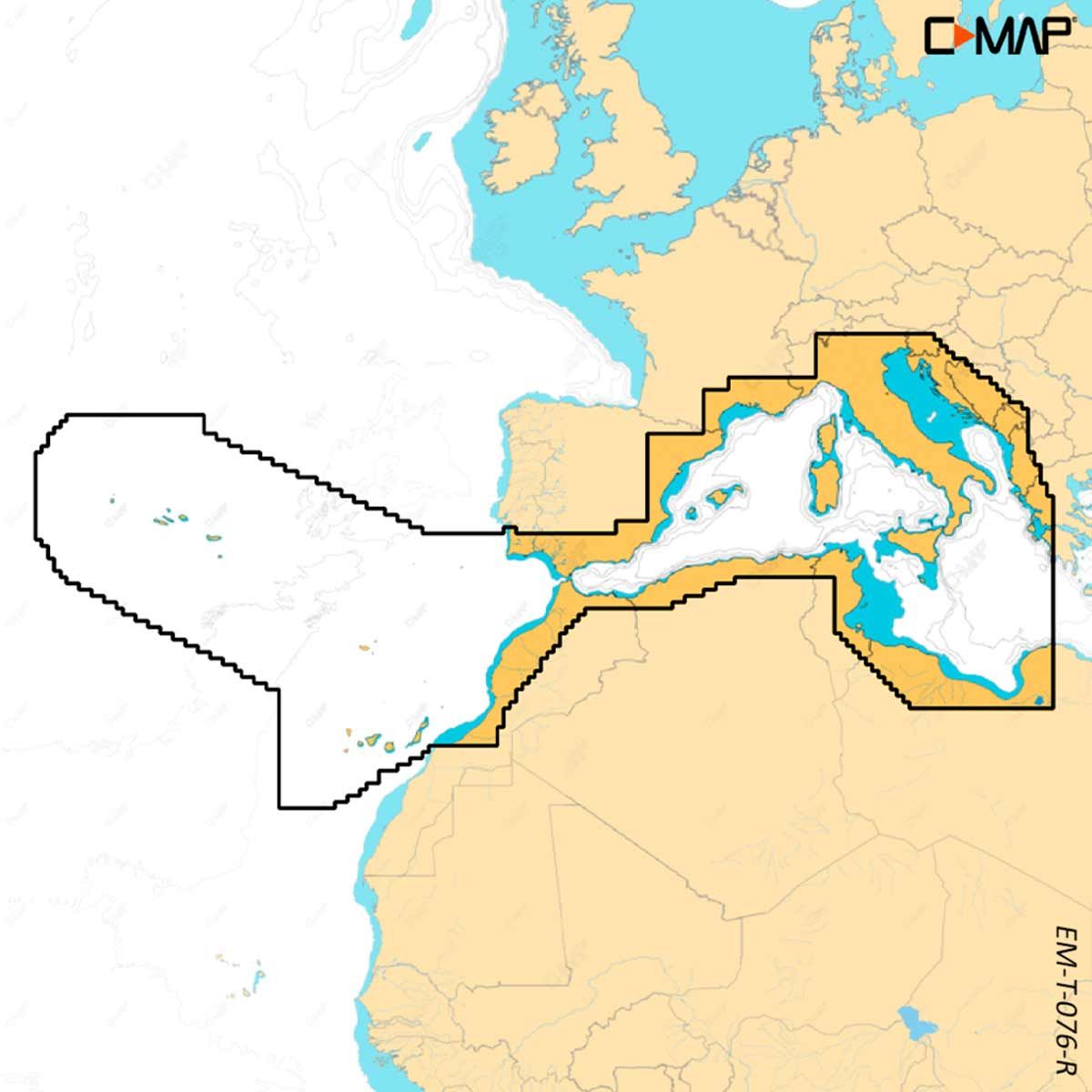
SKU: AF-M-EW-T-227-R-MS
Delivery available | lead times vary
Collection available | usually ready in 2-4 days
Description
Description
C-Map Reveal X Electronic Chart Maps are compatible with Lowrance, Simrad and B&G Chartplotters.
Experience the X generation of C-MAP charts – with game-changing Shaded Relief!
C-MAP REVEAL X offers a fresh, dynamic experience. All the great features from DISCOVER X, including all-new Map Inspector Tool, and more – bring the world around you to life with Shaded Relief and feel connected to your surroundings with Satellite Overlay. REVEAL X charts also deliver smooth integration with the Simrad Companion App and come with 12 months free online updates. Exclusively for Simrad NSX.
Exclusively in REVEAL X:
- Shaded Relief – bring the world around you to life with 3D rendered land and underwater elevation, including areas of ultra-high resolution – a game-changer for anglers and divers
- Satellite Overlay – feel better connected to your surroundings when you find yourself in an unfamiliar place
Next Generation Charts with a fresh, dynamic chart experience, making navigation clearer than ever before:
- Optimised data and new chart presentation to give you the best on-the-water navigation experience
- Always see the data you need without clutter, optimised at every zoom level
- Best-in-class Day & Night modes. Stay safe and navigate with ease, whatever the weather, whatever the time of day
Smooth App Integration - Link to the Simrad Companion App – enjoy the same charts and a fully connected experience:
- Plan trips, review tracks and plot waypoints on the App, then sync straight to your NSX
- Access NSX manuals, “How To” guides and much more, directly from the App
- The future is connected; with C-MAP & Simrad, you’ll be ready
The Best of C-MAP with the latest chart data, with the detail you need to make the most of your time on the water:
- Full-Featured Vector Charts – make navigation easy with accurate, up-to-date vector chart detail from official hydrographic office sources
- High-Res Bathymetry – identify shallows, drop offs, ledges, holes or humps, with accurate contours down to 1-foot. Includes the best of C-MAP HRB data
- Subscription-Free Auto Routing – Automatically plot the shortest, safest route based on detailed chart data and your vessel information. With C-MAP, Easy Routing is always subscription free
- Custom Depth Shading – set a clear visual safety depth or create your own shading and level-up your fishing to see things your way
- Harbour & Approach Details – approach any harbour and inlet with confidence. The perfect conclusion to a long cruise or an exciting day of fishing
Map Inspector Tool allows you to quickly access the information you need, with a simple touch of the screen:
- Tides & Currents – detailed projections of water level and tidal data to help you plan your day out
- Detailed Marina Port Plans – docking in an unfamiliar port is no problem when you have precise layouts of thousands of marinas, including slip spaces, restricted areas, and other vital information